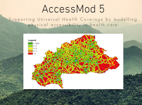
AccessMod (version 5) is a free and open-source standalone software to model geographic accessibility to health services. The tool uses information on population location, health facility location, geographic environment, road network, and access to transport, in order to model how patients within a health system would access different types of health services. This information can support planning (infrastructure location; health worker density; referral systems, supply chain transport; etc) and evaluation (how equitable is access to the health system; to what extent can the population access health services in a timely manner). The tool provides important information to inform policies to increase equity in access to health services. It can also be used to promote efficiency, by determining the optimal location of specialized health services in relation to population location. It may be used to identify where to place new health facilities to increase population coverage through the scaling up analysis.
The tool is available in English and French.